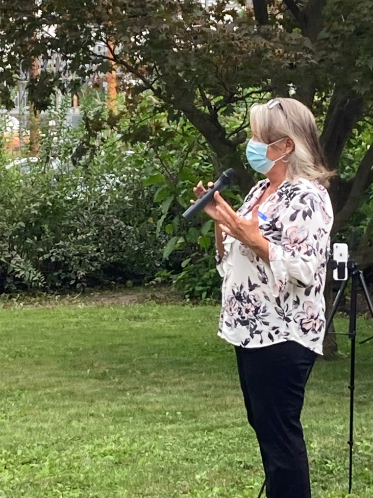
I am sure that my beloved Stellar jays at my patio in Lake Tahoe thought I was crazy as I stood there Monday morning, July 13, with my arms outstretched telling them I love them, and that I’d be back. I’m not quite certain when I’ll be back, but I am dedicated to moving forward to my hometown in Indiana to do what I can to swing the vote against our incompetent, racist, misogynist, anti-immigrant president.
Day 1 - July 13: Leaving Lake Tahoe ~ Nevada Here we Come!
So below, is the first stop that my daughter-in-law and I made on this 2600
mile trip, a dirt turn off from I-80 as we trace the route of the old Lincoln
Highway. Here, I saw a beautiful section of the Truckee River,
which flows out of Lake Tahoe all the way to Pyramid Lake in Nevada. The buttes
in back of us are reflected just beyond the little stone dam. It’s an oasis of
green in the Nevada desert, the Truckee River, touching this arid landscape
with a paintbrush of lush beauty as it flows through the Nevada desert.

Then, further into Nevada!
Lovelock, NV,
is a railroad town, and the Central Pacific railroad had passenger
service at this railroad depot, built in 1880. It is the only remaining station
in a series of residential style two-story station houses built along this
railroad’s route.


It’s hard to know which came first, the name of the town,
Lovelock Nevada, or the tradition of lovers putting locks on chains in
the central plaza near the gazebo there.


We
stopped for lunch at the Cowpoke Café in Lovelock. Time for Pippi
Longstocking to have a look around, and she approved of the food!

It is pretty easy to move rapidly through northern Nevada, with speed limits like this most of the way.

Thunder Mountain: Thunder Mountain
Monument, exit 145 on I 80 in Nevada, part
of our Day One travel. This is a series of art sculptures and architectural
forms that were assembled by Frank Van Zant beginning in 1969. It is both
strange and wonderful, but you really have to see it in person for full effect.


More details from Thunder Mountain. As is appropriate
for a road trip that is trying to see many things along the old Lincoln Highway
transcontinental route, the old cars preserved here are wonderful. In this part
of the road trip, we are traveling the Sierra Nevada Northern branch of the
Lincoln Highway.


Emigrant Pass, with the marker at exit 271 on i80, is
a mountain pass which originally carried the California Trail over
the Emigrant Hills of northern Eureka County in Nevada, reaching a peak elevation
of 6,125 feet (1,867 m). 271 Emigrant Pass must have discouraged a lot of
travelers as they made their way west seeking gold and homesteads
The California Trail was an emigrant trail about
3,000 mi (4,800 km) long across the western half of the North
American continent from Missouri River towns to what is now the state of
California.
For much of this part of the trip, I 80 follows the California trail and the routing goes close to the pass.


On the way to Elko, we gained a lot of
elevation from the flat sandy desert area.
Nature has provided for plenty of entertainment in our trip across
northern Nevada. So many dust devils forming in the hot sandy landscape!
We saw at least a dozen in a couple of hours.

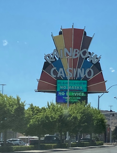
GOOD EVENING ELKO! It’s a busy town, set in the middle of magnificent scenery, and the home of the Cowboy poetry festival, which I have always wanted to attend. Maybe someday, but In the meantime, we settled in to the Hampton Inn, where far too few guests are wearing masks!!!, but we found a local family-owned restaurant named Maddie’s for outdoor dining, and shook the dust off ourselves.

Day 2 – July 14: Elko to Salt Lake
In Elko, the Western Folk Life Center is
the host of the annual Cowboy poetry festival, which will not be held because
of the pandemic until January 2022. But I wanted to visit anyhow, and see its
very pleasant small museum. First, I loved the 18 minute film on how cowboy
life is so conducive to the creation of song and poetry. There was a wonderful
exhibit also about the struggles for land rights in the area. And then, peeking
through the door at the old saloon — closed when we were there so early in the
morning, but I bet that bellying up to that bar would be a lot of fun!.

 |
| This is a photo of the vista in the museum's wonderful film |

ELKO’s Cowboy Gear and Arts Museum has lots of
interesting things to look at, but right inside the door is one of those giant
cowboy boots that you see everywhere in Elko. This museum started as a saddlery
store which was in business for many years. I was interested to see a
genuine coat and gloves made out of bearskin. At first glance, it would seem to
be inhumane, but then when you considered the travails that the early pioneers
had, you realize that they used every part of everything that was hunted. One
of the nice things that this museum and western Folk life center did is that
they offered free bandannas to everyone who comes into the store without a mask;
this is an excellent way to build goodwill, and still assure that other
visitors are protected from the asymptomatic transmission of Covid.


As PIppi Longstocking and I are about to enter the Northeastern Nevada Museum, we stopped to take a look at an actual pony express station which was moved to the outside of the museum. What a great little museum!

I love the old printing press, the exhibit about the Basque people, an exhibit about toys from pioneer days, the canoe made out of Tule reeds and of course the long long gallery of various firearms — we are definitely in Nevada.


We are on the Lincoln Highway, so it’s
time to give a nod to great neon of the past and the present!


Wells, Nevada, Is definitely off the beaten track,
but has a small municipal park with some examples of transportation from the
past century, and a small visitor center with a pioneer wagon and some
interesting signage. It began as a place
called Humboldt Well along the trail to California. It was then founded as a railroad town along
the original Transcontinental Railroad, and was a stopover for passenger
trails. In 1869, the Central Pacific
Railroad established the town formally.
This land belonged to the Shoshone people and archaeologists have found
human remains in the area that date back more than 10,000 years. As well, fossils from Mammoths have been
discovered here too.
The town is modern today but retains a kind of Wild West
flavor. There is a walking tour of the
1880’s wild west district.


West Wendover: Wendover Will welcomes travelers who are Willing to get off I80 for a mile
or two. Pippi Longstocking doesn’t know quite what to think of all this.
However, we are very close to markings of the California Trail, and delighted
to find replica historical markers for the Lincoln Highway here also.


Bonneville Salt Flats: The great salt lake desert provides lots of photo opportunities near Bonneville Salt Flats. Many people walk out onto the salt crust, for some great photos.


In the meantime, many more miles to drive, but there are
interesting trucks and trains to see along the way.


July 14,
overnight in Salt Lake City, Utah.
Day 3 – July 15: Salt
Lake City, Utah, to Rock Springs, Wyoming
GOOD MORNING, Salt Lake City! The beginning of day three of the trip across country finds us in one of the most wonderful hotels I’ve ever stayed at, the Grand America Hotel. In the time of pandemic, it is almost empty of guests, which is sadly fine with me. The cleanliness is fantastic, the service is incredible, and the food is very good in the spacious lobby lounge restaurant. After the months of stay-at-home, the inability to dine indoors, and all of the little daily deprivations that I have gone through (and so has everyone else I know), this is a treat and an uplift to the spirit. We are now 25% of our way to Nappanee, Indiana.

No stop in Salt Lake City is complete without a visit to Temple
Square, but this time, in July 2020, the whole complex is undergoing
renovation. Regardless, the city fathers have maintained the beautiful gardens
in and around that area.


Salt Lake City’s
Heritage Park is truly worth a visit. Along several very walkable and shady
blocks are replicas of many houses from the early days of the Mormon
settlement, and many buildings housing enterprises are there too. Below, the
observatory.


A must–stop on the way out of Salt Lake City, on route to Wyoming, is Coalville. The Summit Furniture and Merc Company has been in business since 1906, and its antler-festooned selling floors are legendary. It’s been operated by the same family for decades. Hard to resist honest Wrangler, Carhart and other goods! Down the street, a sad victim of the pandemic; this deli would have been a delight to visit! Many interesting things to see walking down the few short blocks of Coalville’s downtown. Then, back on I 80 for more adventures.


At ECHO Reservoir, not far from Salt Lake City, Utah, a bright RVing family finds the most magnificent view!


And
then, into Wyoming!

Evanston, Wyoming, our first stop in
Wyoming!. Here is a wonderful example of
a Lincoln Highway marker.


In Wyoming, here were some sights on the way to the famous
stop for gas, gifts, snacks- Little America. This is currently an important rest stop on
i80 (at exit 68). It was first built in
the 1930’s, and moved after a fire at its original location. It was named in honor of Admiral Robert
Byrd’s camp at the South Pole, which was constructed in 1929 on the Ross Ice
Shelf. It’s an extremely busy place with
a huge gift shop, restaurants, and motel rooms.


We were a bit pushed for time, and so we did not detour to
Green River Park itself, which was the 1869 starting point for noted explorer
John Wesley Powell, who explored the Green and Colorado Rivers, and the Grand
Canyon. We passed a series of majestic
buttes carved over time by the river, on our way to Rock Springs.
There are many famous rock formations in this part of Southwest
Wyoming. They are sandstone and shale
beauties that were left behind when waters of an ancient lake receded millions
of years ago.
-The first one we saw was Tollgate Rock, and you can
see it both from i80 and from a point in the Green River. In the past, native Americans crossed the
river here and sheltered from the elements under the walls of the formation. It may look familiar to you; it was a frequent subject of artworks by painter
Thomas Moran and photographer William Henry Jackson.

-Next, the Castle Rock towers above downtown Green
River. It is one of the most formidable
landmarks in Sweetwater County, Wyoming, and the layers of fossilized fish and
plants that form its walls stand as a testimony to the watery kingdom it once
reigned over.

-Last, further East from Green River and on the south side of i80....the Kissing Rocks. Suspended a few inches from actually kissing each other, Native Americans believed that the spirits of two doomed lovers from opposing tribes inhabited the rocks, only to spend eternity just out of each others’ reach. (For more info on these formations, see the Sweetwater County Official Travel Guide )

July 15 – overnight in Rock Springs, Wyoming.
Day 4 - July 16: Rock Springs WY to Laramie WY
We depart Rock Springs and the wonderful formations in this
part of Wyoming, and move on to Rawlins Wyoming, where the major
tourist attraction is the historic Wyoming State penitentiary, often
referred to as “Big Pen”.

There is quite a good short tour of about 40 minutes, which
starts in a room featuring photos of some of the inmates and detailing the
crimes they committed. You wander through a number of cellblocks, and you see
that these folks had all the comforts of home. A barber shop, for instance. In
one of the cells you can see that the walls are splattered with dots, and those
are toothpaste blobs which were used to put up photos of loved ones, or
letters. One inmate in particular had a
penchant for art, and because he had only one arm, he was relieved of other
duties and was detailed to paint these murals in the huge penitentiary
cafeteria.


After Rawlins, we get
off i80 and take 30 (the route of the old Lincoln Highway) on a wide loop north
and east to Laramie.
Medicine Bow has many interesting historical markers and stories. First, there is the famous Virginian Hotel.
In front of that there are notable Lincoln Highway road markers. The hotel was
built in 1911 and full restored in 1984. It was a first class hotel with indoor
plumbing, steam heat and electric lights.
Inside the hotel’s saloon is encased a copy of the famous novel which
made this town and its author famous, open to the page with the quote “when you
call me that, smile.”


There is also a Lincoln
Highway marker at the museum in the old railroad depot there. What’s not
to love about a town which is famous for its bull chip throwing pit?


Como Bluffs Fossil Cabin is 7 miles east of Medicine Bow. The
cabin is made from 5765 dinosaur bone fragments weighing 112,000 pounds. There used to be a museum there (built in
1933) but now this house is on private land, and it has not been
maintained. An important point here -
Wyoming is known for its dinosaur finds.


Pushing on from Medicine Bow and Como
Bluff, next stop is Laramie, Wyoming.
We stayed overnight on July 16 in Laramie
Laramie is the third-largest city in the state. The University of Wyoming is located there;
it’s the only 4-year institution of higher learning in Wyoming, founded in 1886
and with a reputation as a major research center. Laramie is at 7200 foot elevation, and has
constant winds!
From Laramie, we get back onto i80, it’s a short drive of
50 miles to Cheyenne.
Along the way, we stop at the Lincoln Statue at the Summit
Rest Area. (exit 323 on i80) . Today’s rest stop facility was built to
support traffic along the new i80 in 1968.
The Lincoln monument was moved to this location, which is at 8640
elevation. It was originally at the
highest point on the Lincoln Highway, Sherman Summit, which is at 8835 feet
elevation. This is the only namesake
monument along Lincoln’s namesake highway!


Change happens in highway names too…

Cheyenne was bustling in the 1870’s: a large number of miners and prospectors used
it as an outfitting center before they departed for the goldfields in the Black
Hills.
At the Union Pacific Depot in Cheyenne, the 10-foot-high cowboy boots provide a great photo opportunity. This Depot was built in 1886 of multicolored sandstone blocks.

The Wrangler Building was built in 1882, and became named for the Western-wear business (Wrangler).

Also in Cheyenne’s historic district, Dinneen Motors was
built in 1927, and features art deco touches of hexagonal turrets and
terra-cotta.

In Holiday Park, “Big Boy”, Old
Number 4004, was the worlds’ largest steam locomotive with a coal-fired engine,
designed to pull a 3,600-ton train over steep grades without any helper
engines. Big Boy retired in 1956 and is
a great spectacle for kids and tourists today.

This merchant in Cheyenne found a visual way to speak his mind...

Moving beyond Cheyenne’s downtown, en
route to Colorado, we stopped briefly at the dude ranch/tourist attraction Terry
Bison Ranch, which is 12 miles south of Cheyenne, right on the
Wyoming/Colorado state line. It is a
27,500 acre spread where you can ride horseback trails or take a tourist train around the acreage if
you have time, and gawk at 3,200 roaming animals (many bison/buffalo) and enjoy
other aspects of this tourist attraction.


INTO COLORADO, July 17 late afternoon
Then we barreled a bit off course to see my long-time friend
Melissa Wissman and husband Wally Wood at their marvelous retirement home that
they custom designed at the base of Rocky Mountain state park in Estes Park,
Co. Melissa “Missy” was my tentmate in
the cross-Africa trip of May-August 1974, one of a hardy group of travelers on
the back of 3 Bedford army trucks and 2 landrovers; we drove from Tangers to Nairobi. Lots of laughs as we recounted this adventure
of 46 years ago!

Overnight July 17
and 18 in Estes Park
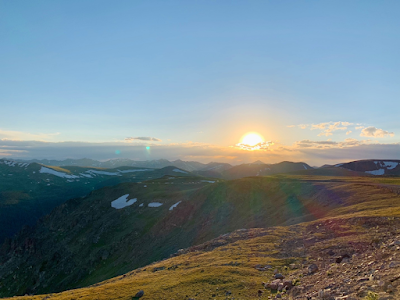
Beautiful sunsets from Rocky Mountain
state park near my friends’ home!
Day 6 - July
18: Enjoying Rocky Mountain National
Park


Day 7 - July 19: Estes Park, Colorado to Ogallala, Nebraska
As we left Estes Park, we took in some
of the sights along RT 34 towards Loveland.
It is a beautiful drive through the canyons formed by the Big
Thompson River.

And who can resist a stop at a famous cherry pie place? The Colorado Cherry Company on Rt 34 between Estes Park and Loveland also gives out free samples!


At Fort Morgan, the road
turns into i76. It was worth a quick
stop in Fort Morgan to see the Rainbow Arch Bridge. It was built between 1922-1923 and is the only open-spandrel
arched bridge of its kind in the state of Colorado. The 1100 feet-long bridge, one of the longest
and grandest of its kind, is currently used for pedestrian and bicycle traffic
across the South Platte River. Well,
HELLO Pippi Longstocking… glad you are enjoying the trip!

A bit off the beaten track, but
important if you are seriously following the Lincoln Highway (and we are
trying…), there’s a 1925 bridge with “DLD” on its abutments. This stands for Denver-Lincoln-Detroit
Highway, and this highway shares the Lincoln Highway from Denver to Sterling.

And now, into Nebraska!
Just over the Nebraska state line, i76
turns into i80. But we got off i80 and
onto Route 30, the Lincoln Highway, at Big Springs, NE.
The Phelps Hotel at 401 Pine Street in Brule was
worth a look. Edwin Phelps was among the
first settlers in the vicinity, and build the hotel in 1885 to snag travelers
on the way to and from Denver. The hotel
was listed in the National Register in 1970.
We imposed on the current caretakers (Randy and Connie Shaw) for a look inside; they were very gracious
and full of historical anecdotes.


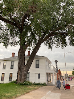
Outside the hotel is a tree that won
an award for being one of the oldest in Nebraska.
We are still following the Lincoln
Highway, and see the road markers at unexpected places….

Near Brule, NE, we also stopped
to see the monument for “California Hill.” Hard to read the notes there, but it was
climbed by thousands of covered wagon emigrants headed west between 1841 and
1860, mostly headed to Oregon and but after gold was discovered in California
in 1848, to California. The most important
crossing of the South Platte River was nearby.
It’s estimated that half a million emigrants passed this way before
1867.

Good evening, Ogallala
Nebraska! Peeking out between the lowering thunder clouds, as the sun
goes down, is a blue eye that I think must surely be the eye of heaven...

Overnight in
Ogallala
Ogallala, Nebraska, was once a true cowboy town knows as “The Gomorrah of the Cattle Trail”

A WPA (Works Progress Administration (see
https://www.history.com/topics/great-depression/works-progress-administration )
mural in the local post office gives testimony to the city’s Texas Trail
days.

We stopped into the Front Street museum to enjoy some of their exhibits. A kind of funky place, a museum and a gift shop all in one, but lots of interesting things to see. Hmmm…. I think we are getting close to Buffalo Bill country!


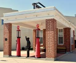
In downtown Ogallala on Spruce Street,
there is a restored 1922 gas station, with its Lincoln Highway marker
out front. You can’t get gas there, but
you can get a good photo!
Boot Hill
Cemetery in Ogallala is a tiny hill that
conjures up images of the old west. It
was definitely worth the time to go up the steps and walk around, visiting the
old gravestones and appreciating the statue that nods to the city’s past. It came to be called Boot Hill as many of the
cowboys were buried with their boots on.
It is worth reading the notes on the historical marker. Other early residents of the city had their
final resting place on Boot Hill.


After we left Ogallala, continuing on Route 30 (The Lincoln Highway), for lunch we stopped at the famous Ole’ Big Game Steakhouse in Paxton, Nebraska. It you are not a vegetarian, it’s not to be missed. Some folks might get upset with the taxidermized animals hanging from the walls all around… but it is quite an experience.


Continuing along some of the back
roads, the Lincoln Highway signs spring up out of seemingly random places. But they provided guidance to early motorists
on this road across the continent.

Still on Route 30 “The Lincoln Highway”, we stopped to admire the murals in Sutherland, NE. There is an original Frontier gas station on the western side of Sutherland, with a recent coat of paint! As early as 1915, Sutherland was mentioned in “The Complete Official Road Guide of the Lincoln Highway” published by the Lincoln Highway Association.


A bit beyond the city of Sutherland, there’s another road marker: we always enjoy those markers which have an image of Lincoln embedded in them.


North Platte is a city in and the county seat of Lincoln County,
Nebraska, United States. It is located in the west-central part of the state,
along Interstate 80, at the confluence of the North and South Platte Rivers
forming the Platte Rive
In North Platte, lots of
things to see, but we particularly enjoyed spending some time in the
observation areas of the Golden Spike Tower. In so many places, the railroads are not far
from the Lincoln Highway/Route 30, and so to see how the trains are assembled,
dispatched and moved is extremely interesting.

Here’s a view from the Golden Spike
Tower, which has a fantastic tour ’way up high. Worth the time!

So much to see along the famous Lincoln Highway in Nebraska! A long and wonderful day of touring on the back roads, mostly Rt 30, with just a quick meal here and there. But who could miss a piece of homemade pie at this special place, the Lincoln Highway Diner, in North Platte, Nebraska? You can visit it yourself at 320 W. Rodeo Road Avenue, North Platte.


Perhaps our favorite stop in North Platte was the Lincoln County Historic Museum. There’s something for everyone to enjoy there – old restored post offices, horse and buggys, old farm equipment, railroad cars.


The Ericsson House at the museum.

The Buffalo Bill Ranch Historic
State Park has many things to enjoy.
His home, “Scouts Rest” was built in 1886 as a place to rest
between tours. You too can become Annie
Oakley for a minute!


Just a few miles from the Buffalo Bill Ranch
State Historical Park is the marker for Fort McPherson. “Fort McPherson was originally called Cantonment McKean, and
was popularly known as Fort Cottonwood and "Post Cottonwood". The
fort was an Indian Wars-era U.S. Army installation in Nebraska Territory
located near North Platte, Nebraska”. Other
than the marker, there is nothing to see these days (see historic map)


Near Gothenburg is the Sod
House Museum. It’s a bit hard to find, located behind Cubby’s Express and
Lasso Espresso at 300 Lake Ave., but is worth the search.


Gothenburg is the Pony Express Capital of Nebraska , so designated by the Nebraska Legislature in 1992.


Gothenburg,
the Pony Express Capital of Nebraska, is home to two original Pony Express Stations. April through October of each year, you can
visit the Ehmen Park Arboretum at 15th and Lake Avenue, to see the
Sam Machette Station. This station was
originally erected in 1854 on the Oregon Trail west of Gothenburg near Fort
McPherson. It was originally used as a
fur trading post and ranch house and from 1860-1861 as a Pony Express
Station. Moved to the park in 1931,
during non-Covid time you can hear a guide tell about the riders who carried
mail 2,000 miles between St. Joseph, Missouri, and Sacramento, California. No guides during Covid, of course, but we
took a look around as best we could.


Near Kearney Nebraska, the Great Platte River Road
Archway Monument -- its name officially
shortened to just The Archway in 2013, spans i80 and is
a log bridge. The exit is 275 off i80,
but we were not on i80 – still on Route 30/Lincoln Highway – and did not go see
the multimedia experience in the arch.
Maybe next trip. Read more here: https://www.roadsideamerica.com/story/9790

Day 9 - July 21: Grand Island, Nebraska to Carroll, IA
We didn’t stay in Grand Island to explore the Stuhr Museum of the Prairie Pioneer and the historic restored Burlington train depot here, maybe another trip? But Grand Island is a railroad town, sugar beet town, and the last stop for provisions when pioneers crossed the plains as part of the Pike’s Peak Gold Rush. Today, Grand Island, Nebraska, takes the prize when it comes to Lincoln Highway signage!


Walking the preserved original section was great fun, as
Burma Shave signs have been placed there.
(This campaign for a brand of shaving cream lasted for decades; I
remember such signs as a girl in Indiana in the mid-1900’s.)


Afterwards, we did the drive-through at a typical Runza place for a quick meal. This characteristic sandwich is considered “a regional cuisine of Nebraska” on the internet, and it’s comprised of a yeast dough bread pocket with a filling consisting of beef, cabbage or sauerkraut, onions, and seasonings. They are pretty yummy!


Continuing on Route 30/Lincoln Highway
after leaving Grand Island, we stopped at the Gardiner Section of the
Lincoln Highway, which is located on a rural part of the Lincoln Highway southwest
of Columbus. This
1.2-mile Gardiner Station section of the original Lincoln Highway and the Pratt
pony-truss bridge spanning Prairie Creek were in use from 1913 to 1928. The fact that the Lincoln Highway ran through
this part of Nebraska assured that the Platte River Valley was a significant
travel corridor in American history.


Continuing our travel on Rt 30/Lincoln Highway, we stopped in Duncan to get another lesson in highway history. As the historical marker notes, Duncan has been associated for centuries with overland routes through the Platte and Loup River Valleys.


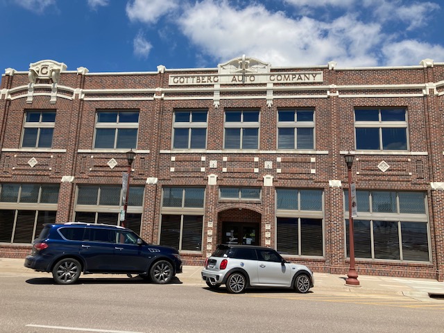
We made a stop in downtown Columbus,
where the town continues to pay homage to its Lincoln Highway days. Lunch at the Dusters Restaurant,
located in the former Gottberg Automobile Supply House.

We are almost out of Nebraska
now. One last important historical sign:

And, in Fremont, in the
John C. Fremont City Park, a simple statue of Lincoln stands atop a
block of stone which bears a bronze tablet of the Gettysburg Address on front.

We continue on Rt 30/Lincoln Highway and this bypasses
Omaha, as we go into Western Iowa. In 1930, the Blair
Bridge or Abraham
Lincoln Memorial Bridge was opened; it carries Route 30 between
Nebraska and Iowa as it crosses the Missouri River near Blair, Nebraska. It was a pretty big deal when it was built,
as you can see from this antique postcard…

WE ARE NOW IN
IOWA!
In Iowa, the Lincoln Highway crosses
the state in a fairly straight line, passing through dozens of little towns
that have kept their classic look. But
each of them tried their best to promote their location on the Lincoln Highway.
Being on the route of the Lincoln
Highway was a big deal for Iowa. Historian
Juliet Landler wrote: “"In September 1912, the Midwestern visionary Carl Fisher
proposed to group of automotive businessmen a plan to build a road spanning
from coast to coast. The route, later named the Lincoln Highway, would start in
New York City, finish in San Francisco, an cross 358 miles through the state of
Iowa on the way. This monumental undertaking was to be privately funded with
the towns and counties profiting from its passage sharing a large part of the
construction costs. Thus, a widespread advertisement campaign for the
transcontinental highway was launched with each community along its path trying
to outdo the next in making itself the most desirable rest stop.”


You are looking at the Loess hills
of Western Iowa… read more below…

We took a look around Woodbine which boasts an 11-block long bricked portion of the Lincoln Highway, the longest remaining original portion of the Lincoln Highway in Iowa. There is also a Lincoln Highway Historic District.


A wonderful house on the brick portion of the Lincoln Highway in Woodbine.

In Woodbine, we are just about at the
middle of the Lincoln Highway’s mileage.
A banner welcomes us!

We stopped for an overnight in Carroll, IA at
wonderful Adams Street B&B. You’ll
want to stay here too! Look at the marvelous
room I had!


Day 10 - July 22: Carroll, IA to Amana Colonies
After we left our wonderful Adams
B&B, which was frankly hard to do, we continued along the Lincoln Highway.
I took a while in Scranton
to find the Lincoln -topped markers on the Moss Farm. Reference books
mentioned the intersection of 210Th Street and East Avenue. But still…. Hard to find. The story is that there are two of these
markers, placed here in 1926 by James E. Moss, who farmed the land and was an
ardent supporter of the Lincoln Highway. Moss was a Civil War veteran who lost
a foot at Missionary Ridge. He had these identical markers erected as memorials
to Abraham Lincoln, whom he considered "one of our greatest
citizens." The original busts
were broken off and have been replaced. An "L" is stamped on the
shoulder of the base, and "J.E. Moss" stamped on front.

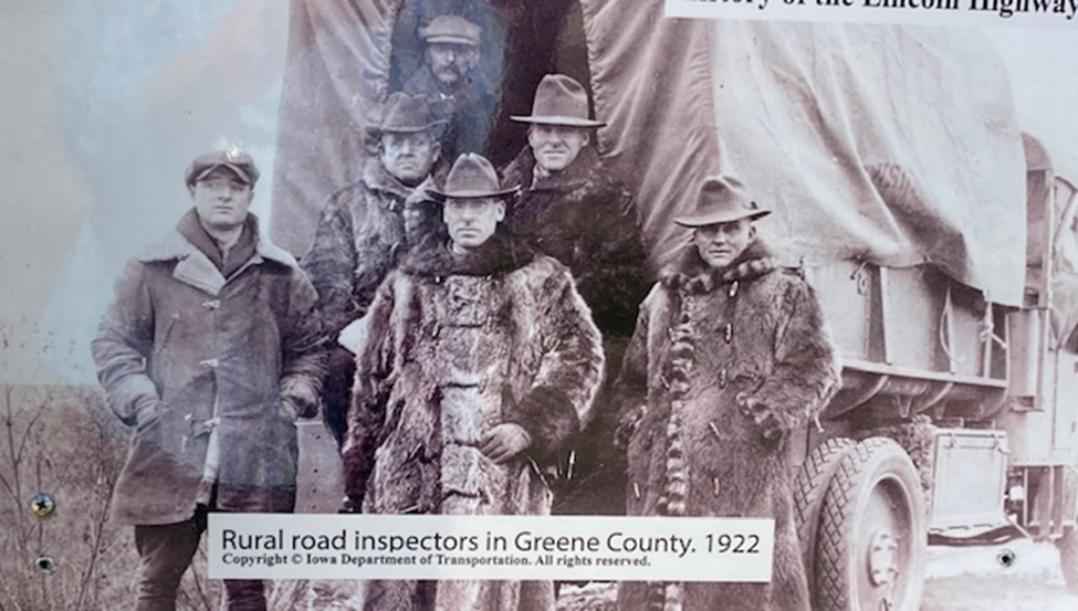
Grand Junction took its name from its position at the junction of the
Keokuk and Des Moines and the Chicago and Northwestern railroads. It also pays tribute to its location on the
Lincoln Highway in many ways. This was
an important part of the town’s history, as many motorists stopped here. The county had a road inspection team that
kept the Lincoln Highway in good condition.

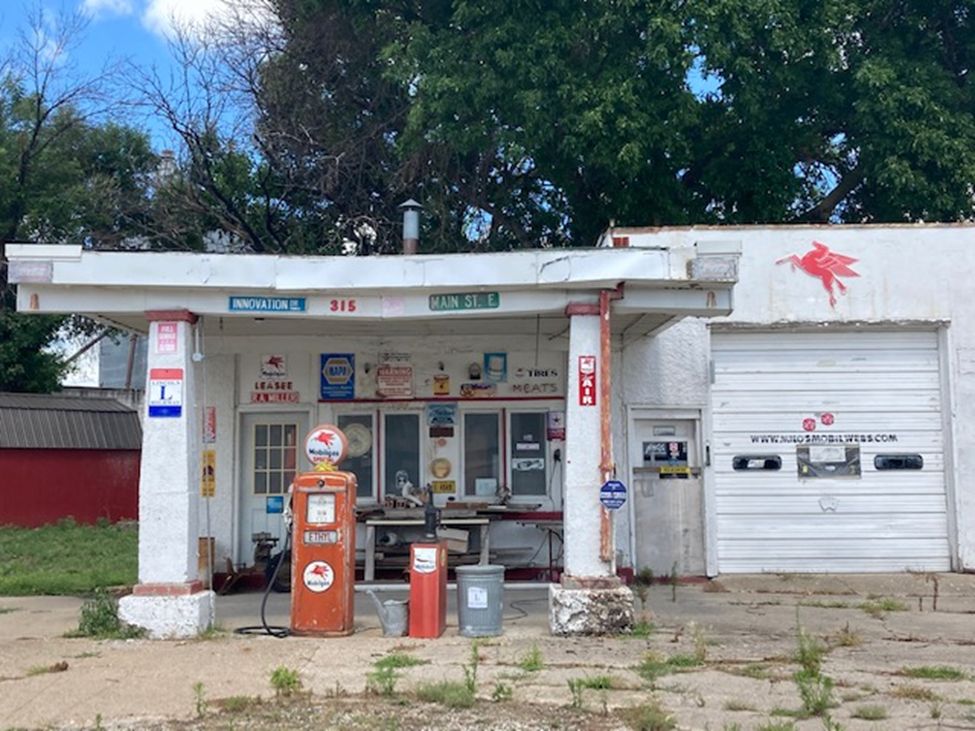
A fellow blogger (http://blog.bubbasgarage.com/) notes this:
Originally a D-X Gas station from the 50's, Milo's Mobil now has
a number of Mobil Gas signs and pumps along with some Lincoln Highway
signage. This great gas station is
located on Main Street just south of Hwy 30 in Grand
Junction.
(Not in service…)
We waited around for the Green
County Lincoln Highway Museum giftshop in Grand Junction to
open, and finally convinced the server in a nearly ice cream shop to call her
boss, who has the key. It was great to
look around at the memorabilia there, and it would have been nice to add a few
souvenirs, but no one was available to make a sale. Hope it opens soon for other travelers! (200 Main Street)
On we go to COLO, IOWA,
where the Lincoln Highway crosses the Jefferson Highway. The Jefferson Highway, organized in 1915, ran
in a north-south direction between New Orleans and Winnipeg. The L&J service station, opened in
the 1920’s, has been restored (but it not in service). About 50 feet away is Niland’s Café, a
great place for a quick bite to eat. It
is decorated with highway history posters and other Lincoln Highway
memorabilia.


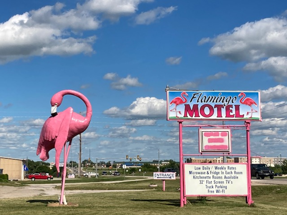
A short detour off Route 30/Lincoln
Highway took us to Marshalltown.
Who could resist a few extra minutes on the road in order to see the Flamingo
Motel?
Then onward to Tama, Iowa,
which has the most famous bridge on the Lincoln Highway. This 1915 concrete bridge, constructed 3
years after the formation of the Lincoln Highway Association, was one effort by cities along the route to
promote automobile travel and encourage economic development. When Route 30 was
re-aligned, the bridge remained open to carry local traffic. It crosses over
Mud Creek on 5th Street E in Tama.
Pippi Longstocking wanted to get a closer look!


On we go, to see some characteristic
scenery in Iowa...


We are mostly following Route 30/the Lincoln Highway in Iowa,
but today we deviated from our Lincoln Highway trip in order to visit the
Amana colonies. This certainly is a gorgeous area! A late evening walk
shows the wonderful structures of this colony, built as a communal society in
1855. This religiously persecuted group of Pietists left Germany in 1843 to
first establish a community near Buffalo, New York, and then looked west for
attractively priced land in this valley near the Iowa River. It is eerily quiet
here tonight, and like many other major tourist attractions in the time of the
pandemic in the United States, the crowds are missing and the merchants in
these tourist areas are suffering.


We stayed overnight in a hotel located in the Amana Colonies.
Day 11 - July 23: Amana,
IA, to Geneva, IL
When we left Amana, we took a bit of a
deviation and got back on the Lincoln Highway near Mt Vernon, Iowa. Our first tourism stop of the day was Mechanicsville,
to admire the mural.

Next stop: Clarence, Iowa,
where the city welcomes today’s Lincoln Highway travelers with a Heritage
Crosswalk painted in 2019 and kept fresh every year. As noted on the historical plate, Clarence’s
Main street became a link in the Lincoln Highway. It’s a point of pride for the city!


A few miles further, we are in Lowden. The Lincoln Hotel was built in 1915 and
rehabilitated in 1996. It is now a hotel
with four suites available, and is listed in the National Register of Historic
Places.

We head toward Clinton, Iowa, and note the many stately homes built there in the 1800s.

On the Clinton side of the Mississippi River, Pippi Longstocking and I were able to look across the Mississippi river from the Iowa side, near the base of a historic lighthouse, just before we entered into Illinois. It really is an amazing river, often referred to as “the father of all waters.”

Route 30 now crosses the Mississippi
River on a bridge that was built a mile south of the original span.

WE ARE NOW IN
ILLINOIS
Just on the other side of the bridge, we detour a few miles off Route 30 to go to the Welcome Center at Fulton, IL. At the Welcome Center, there is a 90 foot tall working windmill, built in 2001. This is in recognition of the Dutch heritage in this town, and there is actually a flood-control dike in the heart of the city. The Lincoln Highway originally crossed the Mississippi here via a bridge that charged vehicles a toll of 20 cents for the driver and 5 cents for each passenger.
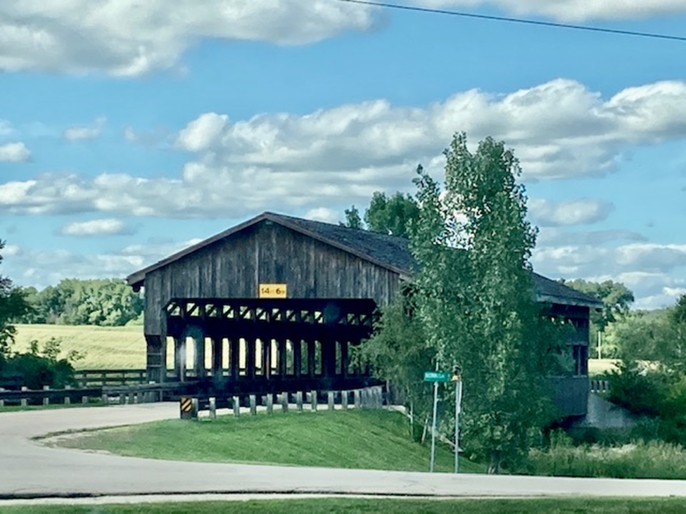
Back on Rt 30/the Lincoln Highway, we stop in Morrison, Illinois, where there is a plank-deck covered wooden bridge. Built in 2001, it crosses over Rock Creek, on Crosby Road. It is lovely to look at, and it is open to traffic.
A few short miles north of Route 30,
the town of Dixon, Illinois features a statue that
memorializes Abe Lincoln as a young soldier in the Blackhawk War. One of the reference books used to plan this
trip has the following note: “In 1860,
Dixon surveyor and politician Joseph Crawford took Abe Lincoln for a ride on
the road that a half century later would become the Lincoln Highway.”


There were a few other stops we could
have made… Franklin Grove (which has a Lincoln Highway Association
Headquarters … but closed because of Covid….);
Rochelle (where the Lincoln Highway intersects with the Meridian
Highway, a predecessor to US 81); DeKalb
(the “barbed wire capital of the world” with its art deco Egyptian Theater
built in 1929) but frankly we were tired and headed straight to Geneva,
Ill.
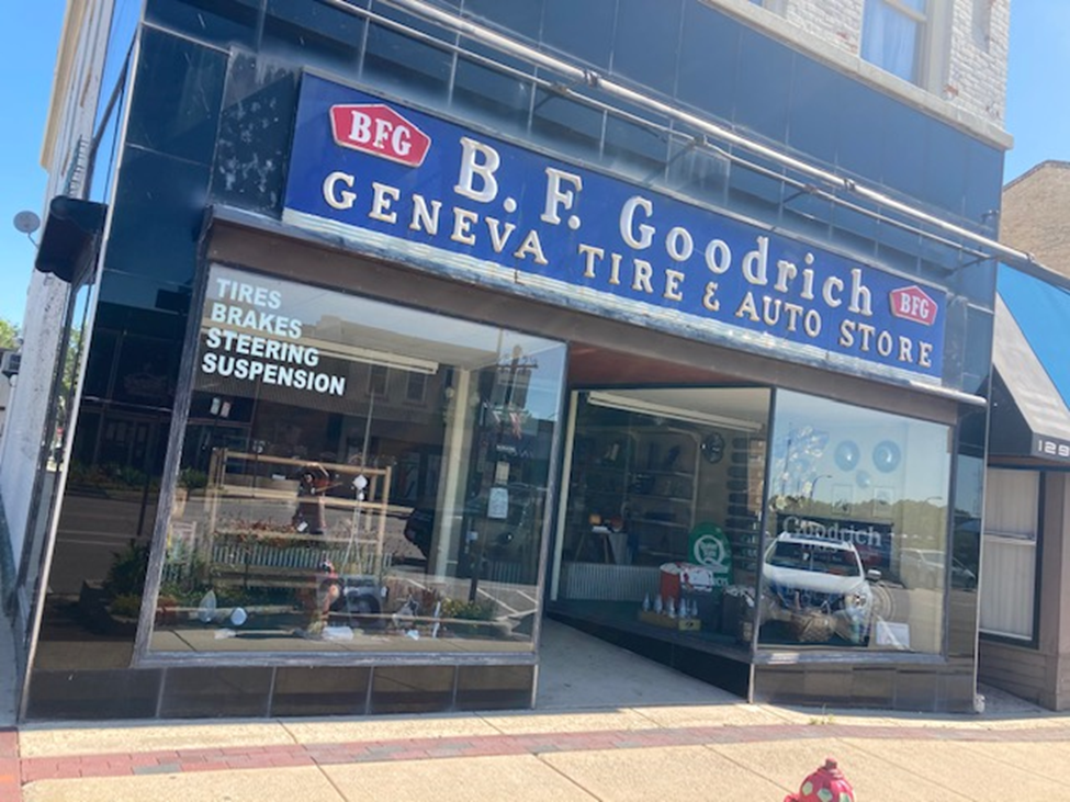
There in Geneva is an authentic B.F. Goodrich store that’s well preserved, and a downtown that looks like a movie set.
Overnight in Geneva, at the Herrington Inn & Spa,
overlooking the Fox River. What an
incredible place! Worth a trip for a
weekend getaway!

It was Covid, so they served dinner in
the gazebo

DAY 12 - July 24: OUR LAST DAY – Geneva, IL to Nappanee, IN
Aurora, Illinois has many historic districts and neighborhoods
with work done by such architects as Frank Lloyd Wright. Of particular interest is the Paramount
Theater designed with a Venetian theme combined with the fashionable
Art Deco influence of the 1920s and early 1930s. It was built in 1931, and offered movies as
well as vaudeville, concerts, sing-a-longs and circus performances. It was restored in the late 1970’s and you
can take a tour of the theater for $5; call (630) 896-6666 to make a
reservation. (Next trip!)


In Joliet, Illinois, Route 66 and the Lincoln
Highway share several miles of roadway.
Also, US 6, the Grand Army of the Public Highway (connecting Cape Cod,
Massachusetts, with Long Beach, California) runs through Joliet. Pippi Longstocking really wanted to learn
more about Joliet and Route 66, but sadly the visitor center and the
Joliet Area Historical Museum were Covid-closed. We will simply have to come
back when the virus is under control.


Dyer, Indiana The
“Ideal Section” of the Lincoln Highway
is located here. In 1920, the LHA decided to develop a model
section of road that would be adequate not only for current traffic but
for highway transportation over the following 2 decades. It was
conceived by Carl Fisher (developer of the Indy 500) to encourage building good
roads. Completed in 1923, designed and built as a model for road construction.
It was funded by county, state, and U.S. Rubber Co. Features included a 100
foot right-of-way, 40 foot paved width, 10 inch steel-reinforced concrete, underground
drainage, lighted, landscaped, bridge, and pedestrian pathways. Tough to find
as the cars whiz by, but parking up the road and walking back has its
rewards. I’ve put enlargements of the
plaques into this blog too. They tell
more about the history of this route!


Last stop: Nappanee, Indiana,
and the very visible 1916 house I acquired, right across from the post office,
on US 6. A perfect place to put up Biden/Harris
yardsigns!

End of an incredible trip! Many thanks to my fantastic daughter-in-law for her company, patience, and joy-of-life attitude. And now, time to get right into the political work! My mission is to build a Democratic city club in my hometown of Nappanee (which I left in 1964 after graduating from high school) and also to include the nearby town Wakarusa, Indiana…. Both are in a very red Republican area. 5 days later, here we go!