Day 1
Day one, Mile
zero, Palo Alto CA. My old friend Johan and I have finished packing Martin
Keck's SUV with suitcases,books, bike and on top of it all the Bob blanket.
Next stop is Barstow where we pick up Route 66. 12-24 days to Boston. Stay
tuned !
Small glitch...Johan left his camera in San Francisco... So back he went... Oh well...just one of the adventures to come I think...
Small glitch...Johan left his camera in San Francisco... So back he went... Oh well...just one of the adventures to come I think...

En Route to
Barstow
Casa de Fruta near Los Banos,CA. Middle of day one, Road
Trip SF to Boston. This is a must-stop! Now filled with family entertainment,
for decades it's had the best cup of coffee en route to i5 and then Barstow


Shortly after Los
Banos, there is wonderful reservoir. Since we got a late start, dusk caught us
there. Casa de Fruta signs: That
reservoir means that this area of California grows a lot of fruits and
vegetables. These signs tell part of that glorious story of American
agriculture.


Day 2
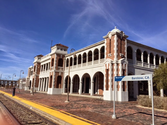
Railroad
Depot near Barstow
There is a
wonderful museum here. This was a depot for the old Santa Fe railroad line. The
train tracks are still active. I'm
bringing Mateo a “date nail” from here


 |
| a date nail
It doesn’t take long to drive from Barstow, CA to the
Mojave desert and then into Arizona. We
tried to stick as close to Route 66 as possible. Much of this famous highway fell into ruin
when Route 40 (the interstate) was put through, like in the film “Cars”. Originally Route 66 pretty much paralleled
the Santa Fe Railroad line,

We stopped in Needles CA for lunch. There is a cafe here
called Juicy’s River Cafe... And the Colorado River is about 1/4 mile away.
Imagine! Right here in the middle of the desert!
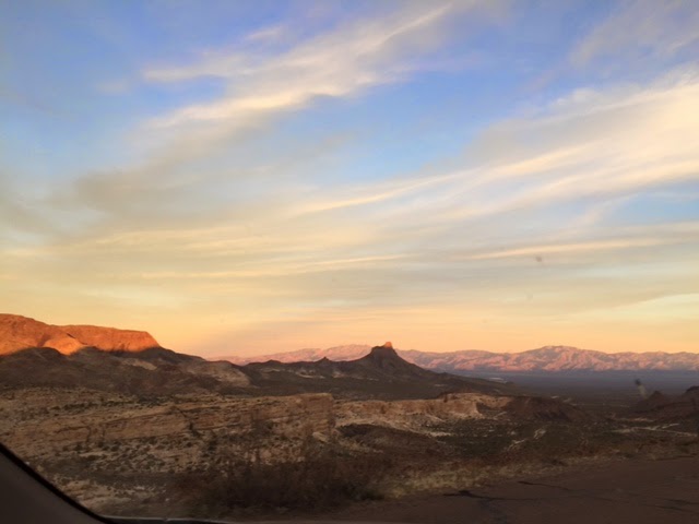
We are soon in Arizona. A lot of people find driving in
the desert boring, but I love the contours, the colors and the way both
seemingly shift when a cloud passes overhead.
Wild
burros in Oatman AZ on Route 66
This town is known for its population of wild
burros. They roam freely everywhere. I had an apple in the car to break apart
and feed them...okay, not by hand but they didn't mind having a little dust
with them from the street where I tossed them.

There were
lots of funny store signs in Oatman!
  
END OF DAY TWO...
There was a
beautiful sunset on our way to Seligman!
This hotel
is our destination for Saturday night: It is at the intersection of old
historic Route 66 and U.S. 40

Day 3, we reached the Grand Canyon!
 
Day
4
We
see the Painted Desert on our way from the Grand Canyon to the pueblos at
Wupatki

It
would be too sad not to combine a trip to the Grand Canyon with a trip to the
nearby Wupatki pueblos...by 1180 thousands of people were living and farming
northeast of Flagstaff AZ. Erupting volcanos forced their departure and you can
see cinders and lava from the Sunset Crater nearby. Worth your time to visit
this National Park too
|


What
a pleasant surprise! Back on Route 66, a magnificent restaurant at the La
Posada hotel in Winslow AZ...designed by Mary Colter for the Harvey Company.
Right at the side of the Santa Fe Railroad tracks and recently
renovated...guess what, Amtrak stops there. Really not to be missed I want to
go back! Below is a fanciful placemat from the restaurant...

The famous sign in Joseph
City AZ
A
famous sign on Route 66 near Joseph City on the way to Gallup NM, The
Jackrabbit Trading Post ...

Day 5 –
Gallup, New Mexico
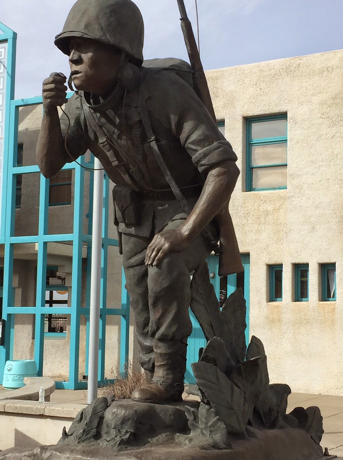
Indian Code Talkers Helped Win World
War II
Today in Gallup NM (New Mexico) we went to an
exhibit that explained how Navajo high school boys were asked by the US Marine
Corps to join and develop a code for sending messages that the Nazi and
Japanese armies could not break. This is because the Navajo language is very
complex and when combined with a few other tricks,..well, no one could break
the code. This allowed American troops to find supplies and the best fighting
positions. Here is a statue dedicated to them.
Day 5: the Continental Divide
About 20
miles east of Gallup NM is an easy-to-miss sign marking the dividing line of
our continent. Rainwater which falls to the west flows to the Pacific Ocean,
while rainwater which falls to the east flows toward the Atlantic via the Gulf
of Mexico

Today we visited the Petroglyphs National Monument in Albuquerque NM
which features petroglyphs created by Native Americans between 400 and 700
years ago as they traveled through and lived in this part of the Rio Grande
Valley. I saw just a few of them...there are over 20,000 images pecked in stone
...of animals, people, insects and geometric designs. You can walk right up to
them...but of course no touching!


Now, on to
Sante Fe! But yikes, it was snowing
there!
Day 6 -- Santa
Fe:
It
snowed on Tuesday night in Santa Fe but Johan and I went to a lot of museums
and saw a lot of art on Wednesday anyhow... It's everywhere... !
I was pretty tired from 8 hours of that museum-trekking!
I was pretty tired from 8 hours of that museum-trekking!


This statue
is about ten feet tall and made of materials that were in the recycle bin of
the school attended by art students

Day 7, into
Texas from New Mexico
This photo was
taken on Route 66 near Santa Rosa in New Mexico. It's midway between
Albuquerque NM and Amarillo Texas You won't see Route 66 on your map, you'll
just see route 40 as it's a major east/west highway. So many of the famous restaurants and hotels
closed when Route 40 bypassed old Route 66…. Sad.

More on Road Trip Day 7 : The Big Texan, a famous and well-promoted
restaurant in Amarillo


And then,
with full stomachs, we drove on pretty late to get to Oklahoma City
Day 8: Motoring through Oklahoma
I was pretty
impressed with what I saw of Oklahoma City and it had all my favorite things...
Used bookstore, donut shop, Starbucks. But the drive through Oklahoma to
Missouri was miles and miles of miles and miles, punctuated by a lot of church
signs and massive truck traffic. As the old advertising campaign said, and it's
true, America's needs move by truck!


Missouri...also
on day 8, after Oklahoma

Day 8… to break the
looong drive, we pulled into St Charles, Missouri to visit the Bass Pro Outdoor World
store, oops, complex. This place has everything you need for outdoor fun and
survival, with huge aquariums and displays and presentations to entertain all
family members. A must see!


Day 9: St Louis, Missouri
This statue
of Dred and Harriet Scott is an important civil rights monument. They filed
suit for their freedom at this courthouse in St. Louis in 1846. The Supreme
Court decided in 1857 that all African Americans were NOT citizens of the
United States. Opposition to the decision was one of the causes of the Civil
War and led to the 13th, 14th and 15th amendments to the Constitution.

There was
lots more to do in St. Louis. We went to the Jefferson National Expansion
Memorial which houses the tram ride up to the top of the 630 foot (63 stories)
Arch. Great views of the city and the Mississippi River from there!


More on St. Louis…
The Museum of
Westward Expansion at the base of the Arch in St Louis reminds us that this
city was the Gateway to the West. It also chronicles the dust bowl (so sad) and
the accomplishments of some citizens... Like Lindbergh and his famous flight,
 |
| "This is a hard life to swallow, but I just couldn’t sit back there and look to someone to feed us” 
It’s
important too, when we travel through the Great Plains, to remember that we
took this land from the Indians… that they are the owners really, and that WE
are all immigrants!

Road
trip days 9 and 10...
Family visits in Indianapolis. What a pleasure to see my brother's
granddaughter EliAnna
enjoying the cowboy hat I brought her from Arizona. Ride 'em cowgirl!
Road
trip day 11. BACK HOME AGAIN IN INDIANA!
Today, I left
Indianapolis (Indy) for my hometown, Nappanee,
Indiana.
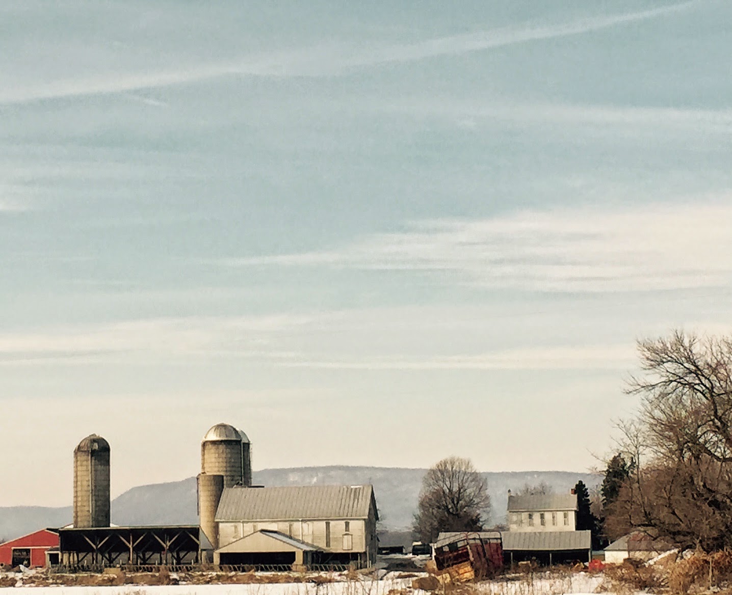
Back to basics... Farm country.

We will be here
two days as we decide how and where to hang out and avoid Juno and the blizzard
in NYC and Boston. No sense heading east until it's cleared up and safe to
drive. This is a road trip, not a death march.
Road Trip days 11,12,13 and 14.
Staying somewhat still these days
while I wait for Boston to recover from the blizzard before I continue east..
But that doesn't mean no driving. Nope, I've been back and forth to visit
friends and family on US 6, which is a major road to -- and through-- my
hometown of Nappanee Indiana.
This is a pretty famous road and
below is some info courtesy of Wikipedia. "U.S. Route 6 (US 6), also called the Grand Army of the Republic
Highway, a name that honors an American Civil War veterans
association, is a main route of the U.S.
Highway system.
It currently runs east-northeast all the way from California to
Massachusetts.
From1936 to 1964, US 6 was the
longest highway in the country.
(as
a little girl, I used to sit on the curb in front our our house on Market
Street, where US 6 went through Nappanee, and look for license plates from cars
from out-of-state. There were lots!)

Nappanee Street Art
It might look like
Nappanee Indiana is just a sleepy little town in the middle of Amish country,
but look at the great street art scene! Okay, maybe the deer sign doesn't
qualify but it's important to a certain segment of the residents...
     
This must be
where I got my sense of humor from…
 
Walking
Down Memory Lane
For some, the scent of freshly turned earth or newly
harvested fields, the soft or harsh gust of wind on your cheek, the regional
twang or turn of phrase... those evoke "hometown" most strongly.
That's true for me too, but some iconic buildings that you see every day
growing up are indelibly patterned in your memory too. I spent much of day
13 of the Road Trip wandering the two blocks in either direction from the
intersection of Market Street and Main Street in Nappanee Indiana...a walk down
memory lane...
 
I thought we'd be in
Boston by now. Ha! Blizzard Juno changed all that. Today in Nappanee I visited
my parents memorial bench that I had installed many years ago in the family
cemetery. It's pretty old, that cemetery, with gravestones dating to 1802. Imagine! The
Brumbaughs were farming in northern Indiana while the Bostonians were still
washing dishes from the Tea Party (well, almost...)

Day 17...
Road trip postponed again...snowing in Indy and my muscles crying out for a walk. What better place than the large indoor Fashion Mall at Keystone Crossing. Nice public spaces too and I loved this mannequin dressed in shopping bags. They seem to be free in the Midwest unlike the 10 cent penalty in San Francisco…  |
Day 18…. To visit friends in
Cincinnati
Day 19 … Moving Toward Boston Again
Driving from
Ohio to West Virginia and into Pennsylvania, a full moon illuminated the
freeway

Day 20 Road Trip improved as I marveled anew at how very pretty Pennsylvania is
Day
21 and 22, of the 'Way Too Long' Road Trip.
I'm waiting out the latest snow in Boston at the
Courtyard Marriott in Lansdale PA, which is near Philadelphia, and I'm looking
forward to a day off the road and will have dinner with old friends tonight.
Day 23, on the road again.
Motored through New Jersey, made a brief stop in New York City to drop something off for a friend, had dinner in Hartford with my niece Margaret, and then FINALLY, Boston
Motored through New Jersey, made a brief stop in New York City to drop something off for a friend, had dinner in Hartford with my niece Margaret, and then FINALLY, Boston


Day
23 and road trip is DONE.
Which is good because it's snowing in Boston, Massachusetts.
4000 miles ticked off on the odometer of Martin's car. We celebrated with a
look at the map!

How
Many States on this San Francisco to Boston Road Trip?
Were you counting?
4000 miles and 22 days.
1. California 2. Arizona 3. New Mexico 4. Texas 5. Oklahoma
6. Missouri 7. Illinois 8. Indiana 9. Ohio 10. West Virginia
11. Pennsylvania 12. New Jersey 13. New York 14. Connecticut
15. Massachusetts
Were you counting?
4000 miles and 22 days.
1. California 2. Arizona 3. New Mexico 4. Texas 5. Oklahoma
6. Missouri 7. Illinois 8. Indiana 9. Ohio 10. West Virginia
11. Pennsylvania 12. New Jersey 13. New York 14. Connecticut
15. Massachusetts
Well, I won't do this again for a while. And most certainly not in the winter!